Sustainable Tourism in Nepal Himalaya

The term sustainable tourism is aggregate form of community based tourism or Eco tourism or green tourism, which refers to preserve locality. Sustainable Tourism “managing tourism’s impacts on the environment, communities and the economy to make sure that the effects are positive rather than negative for the benefit for future generations”.  Community based tourism is touristic activities to be benefited local community without negative impact for future.  Green tourism is about to encourage to the development of tourism enterprises with minimum impact on wildlife and the environment.
"Sustainable tourism: Tourism that is economically, socioculturally and environmentally sustainable. With sustainable tourism, sociocultural and environmental impacts are neither permanent nor irreversible. – John Beech and Simon Chadwick"
Nepal Village Tour and Hiking
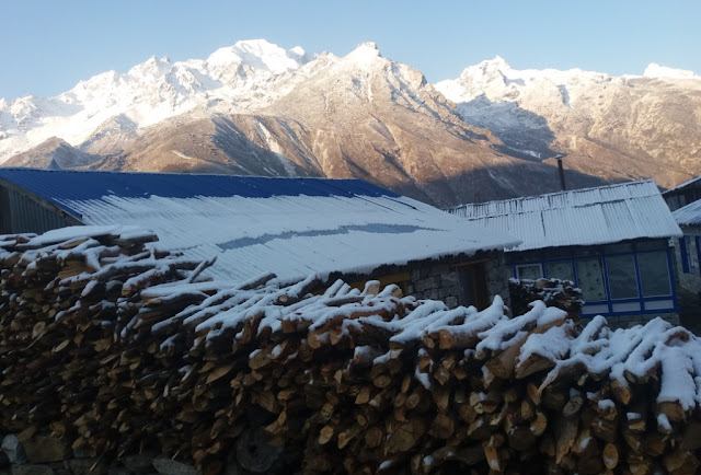
Hiking in Nepalese Village

Travelers are responsible to preserve those fragile nature and cultures. How local people benefited from the tourism in Nepal Himalaya is major question for sustainable tourism. Especially in Nepal Himalaya, local peoples are Sherpa, Tamang, Gurung, Rai, Limbu, Bhote, Lama, Hyelmo; they are living there for past thousands year and should live for long future. Guide and tourist should be conscious and committed for protecting mountains, nature and culture. Trekking, tour or any tourism activities in Nepal Himalaya should ensure the cause of minimal environmental and socio-cultural impact for sustainable tourism.
Guide should encourage to clients/porter/supporter to bring warm clothes to stop the use of campfires, use of filtered drinking water, use kerosene or gas for cooking and dispose the rubbish. Home stay supports the local community and visitors are able to learn and experience the local culture.
Home Stay in Nepal can be one of the unforgettable holidays for sustainable tourism; because Nepal has diversity in culture, community, climate and geography. That is why you plan to go Nepali typical home to understand nature and local culture. The Home stay service offers you for sleeping in Nepali home, eating with the Nepali family, live as local and feel the locality.

First Women Journalists Everest Expedition – 2018 in rigorous training

KATHMANDU, The First Women Journalists Everest Expedition-2018 (FWJEE18) is currently in Dolakha in connection with an intensive training in preparation for their Everest expedition in coming spring season.
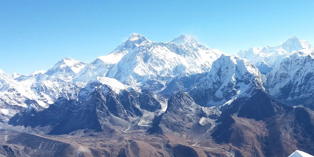
Nepal Himalaya Everest region
Everest Range

The team, comprising five young women journalists involved in different facets of journalisms in the country, are going to climb the highest mountain in the world- Mt Everest (locally known as Sagarmatha) with the slogan ‘Unified Voice for Equity’ in May, 2018.
According to Rosha Basnet of Rastriya Samachar Samiti, a member of the FWJEE18, they have climbed two mountains in Dolakha as part of their training. The two peaks they have climbed are Mt Ramdung (5925 metres high) and Mt Yalung-Ri (5630 metres high), both situated in Rolwaling valley in Dolakha. The expedition members climbed these mountains on November 26 and November 28 respectively.
FWJEE 18 is climbing the world’s tallest peak under the banner of the Federation of Nepali Journalists (FNJ).
The other members of the expedition include Priya Laxmi Karki of News 24, Kalpana Maharjan of Mega Television, Rojita Buddhacharya of Nepal Television and BP Koirala Memorial Planetarium Observatory and Science Museum Development Committee and Deuralee Chamling, a freelancer.
The team is preparing to return to Kathmandu in a few days after completing an intensive training involving rock climbing, ice-slamming and high altitude training among others in the Rolwaling area of Dolakha.
Dreamers’ Destination Treks and Expeditions is going to facilitate the team for their expedition.(RSS)

Nepal Tour Package

This tour package is a complete holiday program which includes all the best part of heritage, nature and culture tours. Visit world heritage sites temples-monasteries and ancient court yard tour of interesting areas of Kathmandu-Patan and Bhaktapur medieval city, scenic popular tourist spot at Pokhara for sunrise with panoramic Himalaya, Asia’s best Chitwan National Park; for Jungle Safari and elephant ride, and Lumbini; the birthplace of Gautama Buddha. 
Elephant riding in Chitwan


Itinerary

Day 1 : Arrival in Kathmandu, transfer to hotel

Day 2 : Sightseeing in Kathmandu Heritage sites
Morning after breakfast at given time, we visit four world heritage site in Kathmandu; Basantapur Durbar Square, Pashupatinath temple, Boudha Stupa, and Swayambhu (Monkey Temple), after an interesting sightseeing back to the hotel, preparation for the trip beyond Kathmandu.

Day 3 : Early in the morning Mountain flight and then fly to Pokhara, Sightseeing in Pokhara
An early morning start for an hour of scenic mountain flight including Mt. Everest then again we fly to Pokhara valley for 25 minute. Transfer to Hotel and sightseeing in Pokhara.

Day 4 : Morning visit Sarankot for sunrise and Drive to Lumbini
Early in the morning we go to Sarangkot for sunrise and Mountain View. After breakfast, We move to Lumbini by driving.

Day 5 : Visit Lumbini in the morning and drive to Chitwan
After breakfast, visit Lumbini. Lumbini is the birthplace of Gautama Buddha, the founder of Buddhism, who was born in the 7th or 6th century BC. Lumbini is enlisted in UNESCO World Heritage Site in 1997. After visiting Lumbini drive to Chitwan.

Day 6 : Jungle Safari in Chitwan
Starting early before breakfast optional jungle activities as per the lodge listed programs elephant safari – jungle or nature walks-dugout canoe ride on Rapti river to view birds life and two species of crocodile the marsh mugger and Gangetic crocodile with bird watching after the great activities refresh for dinner with Tharu cultural folk dance.

Day 7 : Drive to Trisuli River for Rafting and after rafting drive to Nagarkot
After breakfast, drive to Trisuli river for white water rafting. After rafting, drive to Nagarkot via Kathmandu.

Day 8 : Sightseeing in Bhaktapur and Patan and overnight in Kathmandu
We visit old city Bhaktapur Durbar square where we can see Datrataya temple, Nyatapola Temple, 55 window Palace. After Bhaktapur we visit Patan durbar square; Krishna temple, Golden Temple, Kumbheswor Temple and museum. After these entire wonderful trips we reach hotel in Kathmandu.

Day 9 : Transfer for departure

Major attraction of Manang

Local guide for sightseeing in Manang
Manang Youth Society


Manang village:

Location:  4-5 hours from Pisang.
Special feature: Manang is a charming village with all facilities of home. There are many places for day hiking to the surrounding hills to enable you to acclimatize and enjoy the spectacular culture and natural beauty of the  area.

Ice Lake:

Location: 3-4 hrs. walk from Manang village on local trek.
Special feature: The view of Annapurna range and natural beauty of the lake are magnificent as is a walk in yak pasture and habitat for snow leopard.
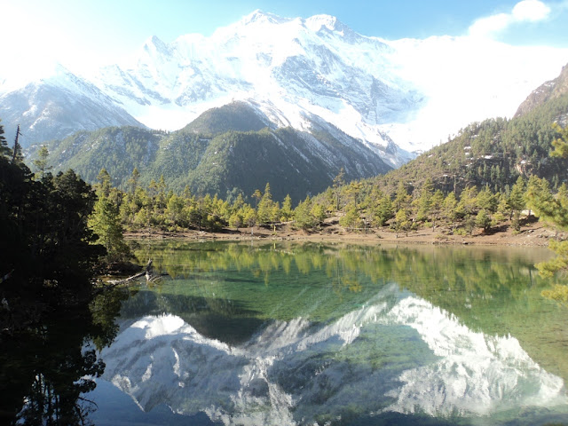
Lake above the Pisang Village
Lake near by Pisang Village

Gangapurna Lake:

Location: Easy 15 min. walk from Manang village to local trek.
Special feature: Spectacular view of Gangapurna peak and glacier.
Ganagapurna Lake near by Manang village
Gangapurna Lake

Tilicho Lake:

Location: 3 days from Manang on the Khangsar/tilicho trail.
Special feature: A trip to the highest lake in the world (4900m) is a good way to acclimatize with good views of Tilicho peak and surrounding valley. On the way up you pass Tare gompa, one of the oldest (500 years in the district).

Yakkharka:

Location: 3-4 hrs. walk from Manang village on the trekking rout.
Special feature: This small peaceful town is habitat for the endangered snow Leopard and unique Blue Sheep. 

Thorong-la Pass:

Location: 2 days walk from Manang village on the trekking rout.
Special feature: The most popular trekking pass as 5416 meter from sea level.
Thorong-la Pass, the biggest pass in the world
Thorong-la Pass

Tal village:

Location – Situated at the gateway of Manang district from Lamjung district on the trekking trail.
Special feature – A relaxing, peaceful small town at the gateway of Manang district. Tal is hometo a beautiful waterfall that flows all year round.

Hot spring:

Location – Dharapani, Latemrang and Chame.
Special feature – Water remains hot all year round for a rejuvenating natural shower or to ease those aching muscles after a long days hike.

Sworga dwari (Gateway of heaven):

Location: Between Bratang and Pisang on the trekking route.
Special feature: Spectacular sheer rock face rising from the Marshyandi River.

Gyaru and Ngwal:

Location: 1.5 to 2 hours walk from Pisang off the trekking trail.
Special feature: traditional village, situated high on the hillside, with some of the most spectacular view of all of Annapurna.
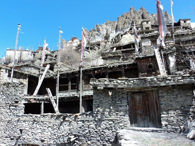
Gyaru and Ngawal village, in Manang
Gyaru and Ngawal village

Braka Gompa:

Location: Braka village,on the trekking trail.
Special feature: This historic Buddhist gompa is typical of the district and a testament to a traditional culture of more than 500 years.
The oldest monastery in Manang
Braka Gomba

Code of ethics issued to systematise tourism in Chitwan

CHITWAN: Tourism entrepreneurs in Chitwan have issued a 16-point business code of conduct to systematize tourism sector of Sauraha.
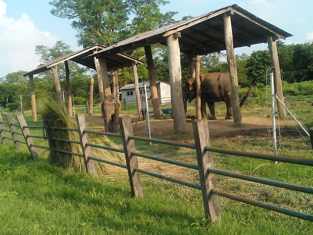
Elephant Breeding center in Chitwan


Minimizing noise pollution, building of tourism-friendly environment and conservation of flora and fauna have been focused in the code of conduct.
A meeting of tourism entrepreneurs from the district agreed to issue the code of ethics aims to better manage the Sauraha tourism’s business, according to tourism entrepreneur Suman Ghimire.
Proprietors of hotels and restaurants have been asked to keep their business open till 11:00 pm in winter and 12:00 midnight in summer.
Likewise, playing of loud music has been prohibited citing that it would cause negative impact on health of wildlife and could disturb them, local and tourism vehicles are banned from blowing horns and tractors and trippers shall be allowed to operate only from 10:00 am to 3:00 pm.
Students on uniform shall not be provided a hotel room until they come with their guardians and wearing of a life jacket while swimming has been made compulsory. Likewise, the use of drone without permission has been prohibited while onwards liquor stores cannot serve their clients in open.
Preparations are on to announce Sauraha a no-horn zone from December 16, according to Regional Restaurant and Bar Association Nepal (REBAN) chair Gokarna Giri. There are a total of 110 hotels and 60 restaurants with well facilities in Saruaha and they have the capacity of accommodating 2,800 people daily.
Sauraha, the eastern gateway to the Chitwan National Park is famous for specially jungle safari and elephant riding.

Annapurna Conservation Area Project (ACAP)'s Activities

Jomsom-Annapurna-trekking
Jomsom
The Annapurna Conservation Area is Nepal's largest protected area covering 7,629 km2 (2,946 sq mi) in the Annapurna range of the Himalayas across the Manang, Mustang, Kaski, Myagdi, and Lamjung districts. The area ranges in altitude from 790 m (2,590 ft) to the peak of Annapurna I at 8,091 m (26,545 ft).

The multifaceted problems of ACA have been addressed through an integrated, community based conservation and development approach, an experimental model which has been in the vanguard of promoting the concepts of “Conservation Area” through an “Integrated Conservation and Development Programme” approach in the country and abroad.

Annapurna Conservation Area Project's Activities: together with local communities

  • Visitor centers: in many places, info + leaflets on local villages and culture, local guided tours, festival dates
  • Check posts: in many places
  • Mustang Eco museum at South end of Jomsom, local culture, nature, geology
  • Garbage/pollution control: awareness, incinerators, clean-up campaigns, toilets
  • Conservation: tree planting, soil conservation, river bank protection, biodiversity survey and protection.
  • Alternative energy: micro hydro plants, solar water heaters, lights, etc
  • Trail improvement: widening, paving, bridges, signs, etc
  • Agriculture and gender development
  • Community infrastructure
  • Health services support
  • Conservation education
  • Heritage conservation
  • Lodge management and training
  • Training for guide and porters
  • Signs and notice board
  • Safe drinking water stations.


Jiri to Everest Base Camp Trekking (Original Route)

Original trekking route to Everest Base Camp starts from Jiri and then ends at Lukla, the wonderful trekking is moderate in the beginning and to adventurous. This trek leads through many traditional Sherpa villages famous as mountaineers and warm hospitality. On this trekking, We can enjoy with the green scenery hills and panoramic view of Mt. Everest (8,848m / 29, 028ft) Lhotse (8,516 m-24,940 ft), Nuptse (7,855m-25,772 ft) and Lho – La or Khumbutse peak (6,036 m – 19,992ft) Mt. Lingtren (6,749 m / 22,142 ft) Chnagtse ( 7,583 m / 25,230 ft) Mt. Pumori (7,161 m / 25,772 ft)  Ama Dablam ( 6,812 m / 22,480 ft) Kangtenga (6,782 m / 22, 380 ft) Tharmarserku ( 6,623 m / 21, 855 ft) Kwangde (6,011 m / 19,837 ft) Kusum Khanguru (6,373 m / 21,030 ft) holy peak of Khumbi-la (5,761 m / 19,012 ft) and as far world’s 5th highest Mt. Makalu (8,463 m / 27, 766 ft) with trekking peaks Island Peak / Imjatse (6,160 m / 20,328ft) Lobuje Peak (6,119 m / 20,192 ft) Pokhalde ( 5,806 m / 19,159 ft) and many other smaller unnamed peaks.
Junbesi village, on the way to Everest trekking from Jiri

This remarkable trek starts from Jiri the old and original gateway to Everest area and then over to famous Junbesi, Takshindo and Namche Bazaar at 3,440 meters over the high pass Lamjura-la 3,530m with enough rest day for proper acclimatization and then heading higher to Imjatse valley through the Thyangboche and Pangboche then finally reaching our destination at world’s highest Mountain base camp at 5,360 meters and then climb up to Kalapathar the highest point of this trek at 5,555 meters and slowly with a scenic walk ending this beautiful and awesome trekking at scenic valley at Lukla.


Annapurna Circuit Trekking

Annapurna Region- Introduction- Since it opened to foreign trekkers in 1977, the Annapurna region has become the most popular trek in Nepal.  The Annapurna Mountains are different, in that the border is well to the north so the Jomsom and Annapurna circuit treks both go north of the Himalayan watershed, into the high-altitude, dry, desert area which is characteristic of the Tibetan Plateau. The Annapurna Conservation Area Project (ACAP) is working to conserve the natural and cultural resources of the Annapurna area.
Annapurna circuit (Thorong –La Pass) Trekking – This trek takes 17 days and reaches a maximum height of 5416m at Thorong - La. The circuit is usually walked in anti-clock wise direction because clockwise is the longer ascent and shorter descent from west to east for the day of Throng-La pass at 5416m.

The trek starts from Beshisahar, Lamjung and ends in big touristic city Pokhara.  We have to fallow frist Marshyandi River and then Kaligandaki River. In this trekking, we can see Mountain Manaslu (8151m.), Annapurna I (8091m.), Annapurna II (7937m.), Annapurna III (7555m.), Annapurna IV (7525m.), Annapurna South (7219m.), Gangapurna (7454m.), Khangsar (7485m.), Dhaulagiri (8167m.), Tilicho (7134m), Chulu (6584m.) Tukuche (6920m.), Machhapuchhre (Fishtail 6997m.), Himchuli (6441m.) etc. This region is rich in flora and fauna.
Annapurna Circuit Trekking

I T I N E R A R Y

  1. Kathmandu to Beshisahar 180km, 7 hour drive
  2. Beshisahar to Bahundanda (5-6 hours) – At the north end of the Beshisahar bazaar, trail follows staircase down to Puwa Khola (Small river), cross and just walk along the road. We find some small tea shop on the way. Next is Balam Khola. There will be wooden bridge in summer time, even in the month October –November. After 1.30 hours from Beshisahar we get Khudi village.  We have to cross Khudi river by suspension bridge. After 40 minutes, we have to cross the Marshyandi River by suspension bridge at Bhulbhule. There are many lodges as well as ACAP check post. There is Lampata village before Ngadi village, cross the Ngadi River. The way is up from Ngadi to Bahundanda (hill). It takes 3.30 hours from Bhulbhule to Bahundanda (1310m.)
  3. Bahundanda to Chamje (6 hours) – The way is steep down and straight to Konigau. There are a few lodges. Next village is Ghermu Phant, there are many lodges. From Ghermu Phant, the way is down to Syange with the frontal view of water fall. We have to cross Marshyandi River by suspension bridge. There are some lodges in Syange. The way is straight from Syange to Shri Chour, then walk up and down to Jagat. There is big settlement. And slightly up way to Chamje at 1433m. We can see the 200m. beautiful waterfalls before Chamje.
  4. Chamje to Danaqu (7hours)- Cross the Marshyandi river nearby Chamje. We can see marijuana on the trail side. Tal is big village. We have to cross 3 times suspension bridge of Marshyandi River from Tal to Dharapani. There is ACAP check post and many lodges in Dharapani. Trekking trail from Manaslu Round (Larke –pass) joins there in Dharapani. The way is straight and slightly up from Dharapani to Danaqu (2300m.). We can see Manaslu to east from Danaqu.
  5. Danaqu to Chame (5 hrs.) – The way is up from Danaqu to Timang (2750m.) Timang village is beautiful, good view of Manaslu. After Timang, the way is straight, a little down and short up to Koto. The Koto is gateway to Nar- Phoo trekking. There is ACAP check post. It takes 40 min. from Koto to Chame (2670m.) Chame is district headquarter of Manang.  There is big settlement with charming view of Lamjung Himal.
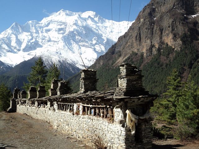
  6. Chame to Pisang (6 hours) -    There is suspension bridge at the end of Chame village. After crossing the river, we get good view of Lamjung Himal and down ridge of Annapurna II from the trail. The trail is straight to Bhratang. There is long mani wall. After some time from Bhratang, again cross the Marshyandi River and trail is up to Dhikur Pokhari. There is pound and some restaurant. The trail is straight from Dhikur Pokhari to Pisang (3200m.)
  7. Pisang to Manang (6 hrs.) -  There are two trails to  get Manang. The short rout is along the Marshyandi River and alternative route, longer route is through the Ghyaru and Ngawal village. Most of trekkers use this longer trail. The way is first straight and then up from Pisang to Ghyaru (3673m.) and straight to NGawal (3650m.). These villages are very old and traditional with the panoramic view of Annapurna range and Gangapurna. The trail bends down from Ngawal to Mungi, where joins the main trail from Pisang, and straight way to Manag through the Braka village.
  8.  Manang to Yakkharka (4hpurs) – The trail is up to Tanki village (last traditional village).  The way is slightly up from Tanki to Yakkharka (4050m.). We probably find yak pasturing.  Yakkharka means yak paturing.
  9. Yakkharka to Thorong Phedi (3 hrs.) – Way is slightly up to Ledar. After Ledar, the way is straight short down and short up. We find a tea shop. Probably we can see the wild animal Blue Sheep. The trail is straight from the tea shop to Thorong Phedi (4550m.)
  10. Thorong Phedi to Muktinath (8 hours) – The very beginning trail is steep up an hour to high camp, and slightly up and up to Thorong la top. It takes 4 hours from Thorong Phedi to top at 5416m. and another 3 hours from top to Muktinath (3800m.)
  11. Muktinath to Jomsom (5 hours) - Trek to Jomsom descends from here, with views of the Kaligandaki River far below and Nilgiri and Dhaulagiri peaks towering in the west. At Eklobhatti Village the trail conjoins with the path from Kagbeni winding along the valley floor through beautiful barren lands with snow capped peaks in the distance.
  12. Jomsom to  Tukche (4 hrs) - Trek along a river bed (where you can look for ammonite fossils) and then by apple, peach and apricot orchards. We will pass through Marpha, a peaceful Tibetan settlement with a large temple and monastery, before reaching Tukche.
  13. Tukuche to Ghasa (6 hour)- We trek along the river valley with a few tributary crossings before reaching Larjung. After Dhampu the scenery changes dramatically, as we enter a pine forest with lush vegetation and have beautiful views of Mt. Dhaulagiri and the Annapurna region. The trek from Kalopani to Lete Khola gradually goes down before the final climb to Ghasa.
  14. Ghasa to Tatopani (6 hour) - The trek is a gradual descent through valleys and fields with beautiful rupse chahara (waterfall) along the way. We will stop in Dana Village, site of the deepest gorge in the world, and have lunch. Tatopani (hot water), where we will be stopping, is home to some wonderful hot springs that sit beside the icy river. It is here that you will have your first opportunity in many days to have a nice soak.
  15. Tatopani to Ghorepani 7 hour - This 13km/7hrs trek is a challenging ascent, but it is well worth the sunset view over the profiles of Mt. Dhaulagiri and Annapurna.
  16. Ghorepani to Pokhara  - The day begins with a pre-sunrise hike (45 minutes) up to Poon Hill (3,193m/10,505ft), the highest hill on the entire trek, for amazing views and photo opportunities of the Mustang and Pokhara Valleys. From the top you can see as many as 30 snow capped peaks, including the Annapurna range and Dhaulagiri. Trek 16km/6.5hrs down to Nayapul (1,100m/3,619ft) and drive 33km (1 hr) to Pokhara.
  17. Pokhara to Kathmandu 210 km 7 hour drive.


Destination Manang

Manang awe inspiring natural beauty and rich cultural heritage make this a truly an unforgettable part of the world. Manang  district is one of the remotest district of Nepal,  and covering an area of 1914 km2, is about a third of ACA area of responsibility. The 5000 residents are physical defined by three regions.
Trekking in Manang

1. Nyesang – which extends Pisang to Khangsar
2. Gyalsomdo – Which extends Tal to Chame
3. Naar Phoo Valley – North part of Manang, which is just opened for foreigners.

1. Nesyang – The upper valley of Manang district, known locally as Nyesang, extends 20 km from Pisang (3200m)to Khangsar (3730m) and lies at an average elevation of 3500m. The inhabitants known as Nyesangpa or more popularly Manangi are said to have migrated from Tengur in Tibet and have settled the area for some hundreds of years. The population of Nyesang also includes Ghale, Gurung and immigrant Tibetan people, although the culture and traditions of the area are strongly motivated by Lamaist Buddhist practices, evidenced by the streaming prayerflags and mani wlls as well as the many Gompa of the area (the oldest of which predate the 14th century). Traditionally the people of the region have been great traders, a fact certified by royal warrant in 1984 during the region of Gorkha Kings. Since that time Manang people have been involved in trading herbs, animal product and other local commodities on the national and international stage. With the decline in urban opportunity and local development of the tourism industry, many Manangi families have moved their enterprises back to Nyesang with particular in hotels, restaurants and shops catering to the tourist trade. Although tourism has become increasingly important to the prosperity of the region, agriculture remains the basic of the local economy and way of life. Barley, Wheat, Buckwheat and Potato are the main crops, which are harvested once a year (march-November). The Nyesang valley also forms important pasture land for grazing yaks, cows, goats, sheep and horse.
Trekking in Manang


2. Gyalsomdo : Gyalsomdo is the southernmost region of Manang district, extending from tal to Chame,  situated in Marshyandi gorge.  The people of the region are mostly Gurung, followers of pre- Buddhist Bonpo religious tradition. However, Ghale, Lama, Gurung, Ghotiya, kami and immigrant Tibetan people have made home in Gyalsomdo. In the past, Gyalsomdo was an important center for the salt trade crossing Larke pass.  Today, the local economy is dependent on agriculture, livestock, wage labor and tourism.

3. Nar –Phoo:  The Nar –Phoo region is the northernmost area of Manang district bordering China (Tibet) and comprising the  very important in this physical isolated region, and like the Nyesang the people of Nar –Phoo are strong adherents to Lamaist Buddhist.


Culturally recommended behavior in Nepal

Namaste means hello
Namaste (Photo Source: Raiguide)

You are a guest in Nepal and it is appreciated if you behave like Nepali.

  • Say Namaste when you meet people.
  • Dress decently (no short or revealing clothes)
  • Do not show affection in public.
  • Do not point your feet (unclean) to people and point with full hand, not with one finger.
  • Do not step over person.
  • Do not touch or step over offering (red powder, flowers, rice).
  • Do not use your left hand (dirtu).
  • Receive and give with two hands.
  • Ask permission before taking people’s photographs.
  • Do not give local kids for pens or sweets.
  • Discourage begging, pay fair prices.
  • Take your shoes before entering a monastery or house.
  • Go clockwise around Stupa, Mani etc.
  • Do not eat, smoke or be loud at religious sites.
  • Women should avoid touching monks/lamas.


Drone flight test at Kalapathar, Everest

A drone flight test was successfully  conducted at Kala Patthar (5600 metre) near Mt Everest in first week of June, 2017.

Drone flight in Everest


The drone is called ‘Lotus’ and its weight is under 0.5 kg. “It is a fully modular 3D printer design to allow low cost and easy maintenance for drone parts showing a high rate of failure in high altitude conditions. The drone is equipped with a thermal camera and visual First Person View camera for navigation and observation.

It took five minutes to set up the drone, ground station and transmitter. The first flight was attempted on Lotus with the flip attached to it, the drone could not achieve flight at 100% throttle.

The drones can be used in extreme environmental as well as man-made conditions. The sensor-equipped, unmanned aircraft was previously used to locate avalanche victims and assist in wildlife conservation projects in Nepal.

Langtang Valley & Gosainkund Trekking after the Earthquake

Langtang Valley Trek is a pleasant trip in Nepal. The Langtang valley declared as Langtang National Park in 1976 and covering approximately 1710sq. km stretching up to the Tibetan border. Trekkers will be surrounded by awesome forest, high peaks and Himalaya range of mountains.
Langtang Valley and Gosaikunda Trekking, kyanjin Gompa


On this trek Langtang Valley & Gosainkund you can view from Annapurna I (8,091m / 26,545ft) Annapurna South (7,219m-23,693ft), 08th highest Mt. Manaslu at 8,163 m, Ganesh Himal Ganesh Himal (7,405 m) Langtang Lirung (7,234 m)  Ghengu Liru(Langtang II 6571m / 21,560ft), and to the south, the Chimsedang Lekh forms a ridge of peaks which includes Naya-Kanga (5,846m) and Gangchempo, Tilman's beautiful Fluted Peak. Beyond it extends to the Jugal Himal, terminating in Dorje Lakpa (6,980m/22,929ft).

Langtang Valley & Gosainkund one of the most popular and trekking region due to its easy accessibility from Kathmandu to Syabrubesi, the trek is moderate with ups and downs trail.

This trek leads through many traditional Tamang villages famous for culture and Buddhist religion and as well for mountain and trekking guides they are also well known for making unique wooden handcrafts and Thanka painting.

This remarkable trek starts from Syabrubesi and into enchanting forest of rhododendron, oaks and pines tree lines where the rare red panda, snow leopard roams with other wild life in this beautiful Himalayan environment.

Drive to Syabrubesi 1,460 m - 07 hrs journey.
Starting this wonderful journey driving towards North West of Kathmandu passing interesting villages and towns with fabulous scenery of hills, farm terraces and snow capped peaks after the warm area reaching to cooler region at Langtang National Park entrance in Dhunche 1950 meters, the one and the only major town of Rasuwa district and Langtang area, inhabited mostly of Tamang ethnic tribes throughout the area of this trekking.
Langtang Valley and Gosaikunda Trekking, Syabrubesi

Buddhism


– Rai Fanindra (Tour and Trekking Guide in Nepal)

Siddhartha Gautam was born in 623 BC. He became Buddha or enlightened in the age of 35 after the six years of meditation. He became the liberated person for the people through his wisdom. Many people are following the path of Buddha is known as Buddhist and those Buddhist thought, wisdom, morality, iconography and practices are known as Buddhism. So Buddhism covers the vast subject matters of Buddhist followers. Buddhism is the perspective upon the nature and consequences of mind and soul; birth, death and reincarnation; liberation and salvation through the philosophy of Gautam Buddha. Tripitak (three baskets) is the main book of collection of preaching delivered to Vikshu by Buddha. The Tripitak is divided into three sections having different realm: Rules of Discipline (Vinaya), Buddha’s discourses (Sutras), Analytical and explanatory texts or commentaries (Avidhamma).
  
Boudha Stupa after earthquake renovation.


Akshybya Buddha

Amitabha Buddha


Amogha Siddi Buddha


Vairochan Buddha

In 6th century BC, Shakyamuni King Shuddodan and Queen Mayadevi were ruling the Kapilvastu state. Mayadevi became pregnant and acknowledged not to give birth in palace. So she had to leave the palace for delivering baby. When she was going to Devadaha (her parental house), she arrived Lumbini (Rumini). She saw a beautiful garden and holy pound, she took rest there. She had delivery there which was the birth of Siddharta Gautam. Mayadevi returned to Kapilvastu and she died after seven days. Gautam was raised by his mother’s younger sister, Maha Prajapati, after his mother’s death. Siddhartha Gautam married with Yasodhara and they had one child, a son, Rahul. Siddhartha Gautam was not happy even he was in palace. He saw the “Four Passing Sights”: an old man, a sick man, a dead man, and saint. Then After, Gautam knew that nothing can stop people from being born, becoming old, getting sick, and dying. So, he left the family and palace at the age of 29 for the quest of knowledge. He went to Bodhgaya and he deeply absorbed in meditation seating beneath the Budhi Tree (Ficus religiosa). He was enlightened after six year of meditation at the age of 35. He enlightened only after having the food given by a women which is called mid- way Path. The name Siddhartha Gautam transformed into Gautam Buddha after enlightenment. And Gautam Buddha delivered his first teaching to five Vikshus in Deer Park, Saranath. Many Vikshus and Vikshuni followed him for salvation during his life time.

Sustainable Tourism in Nepal Himalaya

The term sustainable tourism is aggregate form of community based tourism or Eco tourism or green tourism, which refers to preserve localit...