Pages

Facts of Nepal

Geography

Area - 147181 Sq.km.
Length  –  885 km.  (East to west)
Latitude – 26.22N.to 30.27 N.
Longitude - 80.4 E to 88.12 E.
Being so close to equator our snow line is 16000ft above the sea level.

Geographical facts of Nepal


  1. The longest and highest mountain range Himalayan is extended from Afghanistan to Bhutan. One third of the total length is in Nepal that is 800km. The highest concentration of the highest mountains.
  2. We have more than 1300 peak higher than 6000m. so most of them are not named and known by their group names. About 200 peak of over 6000m. are confirmed to the Khumbu Himalaya that is Everest area.
  3. Eight of the 10 highest mountains of this world are in Nepal.
  4. Between Dhaulagiri and Annapurna lies the world’s deepest gorge –Kaligandaki.
  5. Tilicho Lake at 5099m. Situated north of the Annapurna Himal is the highest lake in the world.
  6. Only 16% of the total area of Nepal is flat. 17% of the total area is covered bypermanent snow.
  7. Nepal has declared 14% of its total land as national parks or wildlife conservation area. The largest area of any country has protected for conservation.
  8. Himalaya called the “Abode of snow” or Kang ri –Snow mountain is a unique highland of our glob. Although Nepal is a very small country, altitude ranges from 70m.to 8848m. above sea level within 150km.of a horizontal distance, the greatest altitude variation on this planate –steepest country.
  9.  If all the surface areas of Nepal were made flat and filled in a open space, the total area would be equal to the United States.
  10. We have the highest number of birds in the world, which is equal to whole continent of N. America or USA and Canada together that is 847 species in.
  11. Nepal has highest number of bio diversity. Nepal holds not more than 0.1% of the total land area of this world, but has the highest number of flora and fauna (10% of the this world)
Geo-political map of Nepal


We find in Nepal

A. More than 5160 native flowering plants,
B. 1666 types of Fungi, 687 Algae, 740 mosses and 450 Firns,
C. 1440 species of spiders,
D. 5052 species of insect,
E. 185 species of fish,
F. 43 species of amphibians,
G. 100 types of reptiles,
H. 32 species of rhododendrons.

Geographical world records of Nepal


  1. World’s highest peak – Mt. Everest,
  2. World’s deepest George – Andha Galchhi,
  3.  Bird only in Nepal – Spin Baller,
  4. World’s deepest valley – Arun valley,
  5. World’s highest waterfall – Shoolighads,
  6. World’s largest Himalayan range – Himalaya,
  7. World’s highest pass – Lughla,
  8. Mushroom only in Nepal- Tryafina Nepalenside,
  9.  Butterfly only in Nepal – Polymat Nepalensis,
  10. Flower in highest palce – Stellari Decumbes ,
  11. River from highest area – Arun River,
  12. World’s biggest rhododendron - Rhododendron Arborium,
  13. Airport in highest place - Solukhumbu, Syangboche,
  14. Lake in highest place – Tilicho Lake,
  15. National park in highest place- Sagarmatha National Park,
  16. Hotel in highest place – Hotel Everest View (Syangboche)

Details itinerary of Annapurna Base Camp Trekking

1. Phedi to Tolka - 
There is steep 450m. up from starting point Phedi (1130m.) to Dhampus. It takes 1.30 hour. Dhampus is nice village and nice view of Machhapuchre (Fishtail) and other mountains. There are many lodges. There is TIMS check post at the end of Dhampus. Next point is Pothana at 1950m. It takes an hour from Dhampus. Pothana is the excellent view point of Machhapuchhre. Thre is 5 lodges and ACAP check post. We have to walk 40 min. further through the forest to get Deurali (2100m.) There are two lodges and another restaurant. We can see Annapurna south and Himchuli. Deurali is highest point of that day so walk down to Bherikharka and straight way to Tolka (1750m.) It takes 2 hour from Deurali to Tolka. There are many lodges.

2. Tolka to Jhinu Danda -
We have to walk first down and straight way one hour up to Landruk (1600m), a Gurung Village. There are many lodges. There is two way at the bottom of the Landruk village. The Left steep down is to Ghandruk village and right way is to ABC. The way to ABC is very nice, pleasant, crossing through the forest, bush, falls and small rivers along the big river Modi Khola. There we find some lodges and restaurant at Himalpani, before New Bridge. We walk one hour to get New Bridge. We have to cross the suspension bridge. Also there is some lodges and restaurant in New Bridge. It takes two hour from New Bridge to Jhinu. We have to cross another river, Kimrong. After Kimrung river way is step up to Jhinu Danda. There are many lodges in Jhinu Danda. That place is popular for hot spring, which is located 20min. down to river Modi.

3. Jhinu to Sinuwa –
We will realize strong way from Jhinu to Sinuwa. We have to walk long steep up, down and again up.But way is not so long. There is steep up from Jhinu to Taulung, 1.30 hour. And 15 min. to Chomrong big Gurung village. We see the close view of Annapurna south and Himchuli. There are many lodges, safe drinking station, small hydro-electricity power station, kerosene depot,phone, internet service, pharmacy etc. Now we are in bottle banned area. We find boiled and filtered drinking water in every lodge. There is stone finely paved way to down, cross the river named Chomrong River and starts again up walk 1.20 hour to Bhanuwa and again up 50 min. from Bhanuw to Sinuwa (2340m.) There are three lodges on the hill. 

4. Sinuwa to Deurali -
Today, we have to walk through the thick bamboo bush and forest. We walk straight, up and down 1.50 hour to get bamboo. There are five lodges. We find lot of bamboo and redodendron trees. And one hour walk to Dobhan. There are three lodges. We walk 1.40 hour from Dobhan to Himalaya. There are two lodges. After one hour walk we rich in Hinkhu cave, we can see Deurali from that cave. It tkes 30 min. from cave to Deurali. There are four lodges. Deurali is located on the buttom of big cliff. That day is interesting and important in terms of flora and fauna.

5. Deurali to ABC-
We walk 2 hour to get Machhapuchre base camp. There is possibility of avalanche if heavy snow there, so be careful. Machhapuchre base camp is nice place. There are five lodges. We can see many mountains. There is established German metrological project and helipad. There is big glacier another side of MBC. Now we have 400m ascent to get ABC. We walk 1.30 hour, if snow it takes longer time. There are four lodges. ABC (Annapurna Base Camp) is beautiful place surrounded by mountain. We can see bottom to top part of Annapurna I, many mountains, glacier, memorial temple and flags.

6. ABC-Bamboo 7 hours.

7. Bamboo to Chomrong 4 hours.

8. Chomrong to ghandruk- 5 hours.

The Ghandruk is supposed to be the biggest Gurung village of that area. Gurungs are mainly involved in British Army since world war. There are traditional houses, Gurung museum, Rodhi Ghar (Gurung cultural theater) monastery, ACAP office, high school, post office, medical center etc. We decent from Chhomrong to Kimrung River and accent to Kimrung Danda and walk straight to Ghndruk, it takes 4.30 hour total time.

9. Ghandruk to Nayapul- 
It takes 4 hour. We walk 2 hour to Syauli Bazaar and another 2 hour to Nayapul. The road is under construction from Nayapul to Syauli Bazaar. There are many lodge, restaurant, tea shops and other kinds of shop. We find Birethanti village before getting Nayapul. In Birethanti, there is TIMS and ACAP check post. And 1.30 hour by car fram Nayapul to Pokhara.

Tengboche Trekking

Tengboche Trekking is the very pleasurable alpine trekking. It takes 6 daysat a maximum height of 3860m. The highlights of this trekking are Sherpa village, Monastery, Mountain View and eco hiking. 
The Tengboche trek starts from Phakding (2840m.) and passes through Namche Bazaar. Namche Bazaar is beautiful Sherpa village but now it looks like an alpine resort than a Sherpa village, because trekkers are increasing. Tengboche is popular place because of big monastery and view point. We find lot of Yak and Jopkyo (crossed cow and yak) on the way. Yak and Jopkyo are means of transportation for this region. 
We find many types of trees and wild life in this region. We can see Chir pine, Blue pine, Junipar, different types of rhododendron and many kinds of herbs and flowers. Probably we can see that birds are Impheyan Pheasant (national bird of Nepal), Crimson-horned Pheasant, Golden Eagle etc. and animals are musk Deer (rare animal in the world) and Himalayan Thar etc.


Everest-Tengboche Trekking

Itinerary of Tengboche Trekking

Day 1 - Fly from Kathmandu to Lukla and start trek to Phakding.
From Kathmandu (Domestic Airport) you will fly to Lukla which takes around 45 min. The plane passes over the fertile middle hills, with their scattered villages and terraced fields, with an amazing panorama of the high Himalaya as a backdrop. After reaching Lukla, stop to have tea or coffee and start the trek to Phakding, a place 3 hours from Lukla. This place would be your first night stop.

Day 2 - Phakding to Namche Bazaar
From Phakding we trek to Namche Bazaar, which was once a small village but since grown in size to accommodate the influx of trekkers, and now is the unofficial capital of the Sherpas. It was once an important trading centre on the route from Tibet to Nepal but has now been largely given over to catering for the needs of trekkers. For acclimatization, we suggest you to spend 2 nights in or around Namche.

Day 3 - Namche toTengboche
Moving on from Namche Bazaar the trail follows the valley of the Imja Khola with some spectacular views of the mountains including Thamserku, Kangtega and Amadablam and dominating the skyline ahead, Everest and Lhotse. The most common night stop after Namche is at the top of a steep climb from the Imja Khola, at Tengboche. This is the site of one of the most significant Buddhist Monastery in Solukhumbu Region and a visit is well recommended.

 Day 4 - Tengboche to Khumjung to Namche
On this day we trek from Tengboche to Khumjung "the sister city" of Kunde.

Day 5 - Namche to Lukla
we trek back to Lukla, situated high above the river on shelf, Lukla is another classic paradox in determining altitude because the runway is on a slope and there is a difference of almost 60 meters between the lower and upper ends of the runway. 

Day 6 - Fly from Lukla to Kathmandu

Gokyo Trekking

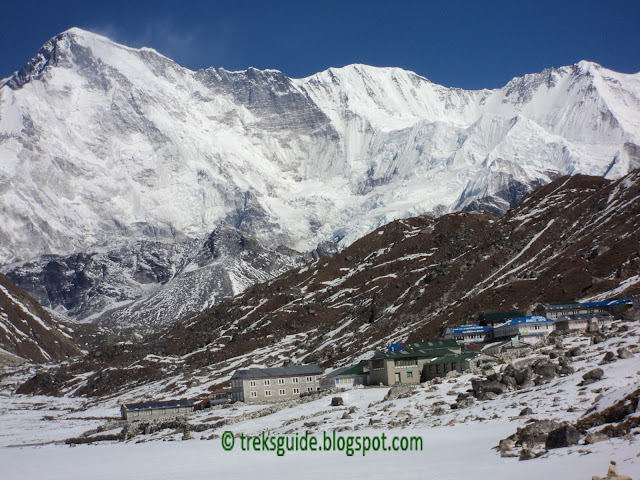
Gokyo trekking is popular for panoramic Mountain View including Mt. Everest (8848m.) and Mt. Makalu (8463m.). Gokyo is located nearby big Ngozumba Glacier and big Lake at height of 4800m. There are many small to big Lakes in Gokyo Trekking. Gokyo Trek takes 10 days including acclimatization day. Gokyo-Ri is the best view point of this trekking at the height of 5350m. We can see Mt. Everest (8848m.), Mt. Makalu (8463m.), Choyu (8188m.) Kangtega (6685m.) Taboche (6367m.), Cholatse (6335m.), Amadablam (6856m.), Lhotse (8414m.) Lobuche (6119m.), Nupse (7861m.), and other many mountains and small peaks.

The Everest trek starts from Phakding (2840m.) and passes through Namche Bazaar. Namche Bazaar is beautiful Sherpa village but now it looks like an alpine resort than a Sherpa village, because trekkers are increasing. Tengboche is popular place because of big monastery and view point.

We find many types of trees and wild life in this region. We can see Chir pine, Blue pine, Junipar, different types of rhododendron and many kinds of herbs and flowers. Probably we can see that birds are Impheyan Pheasant (national bird of Nepal), Crimson-horned Pheasant, Snow pigeon, Golden Eagle, Snow Cocks etc. and animals are musk Deer (rare animal in the world) and Himalayan Thar etc. It is believed that Yeti lives in this region. We find lot of Yak and Jopkyo (crossed cow and yak) on the way. Yak and jopkyo are means of transportation for this region.

Gokyo Trekking Guide

Itinerary in Details 


Day 01- Fly to Lukla (2804 meters) trek to Phakding (2610 meters) 3 hours. 
An early morning start takes us to Tribhuwan International Airport in Kathmandu for the 35 minute scenic flight to Lukla at 2804meters. On arrival at the airport guide will brief you and introduce our porters before we begin our trek towards Phakding at 2610meters. 

Day 02- Trek to Namche Bazaar (3441 meters) 5.30 hours. 
We continue trekking along the banks of the Dudh Kosi, crossing this majestic river many times on exciting suspension bridges laden with prayer flags. After entering Sagamartha National Park, the trail climbs steeply with breathtaking views. Namche Bazaar known as the Gateway to Everest which is home to many quality restaurants, hotels, lodges, shops, Money exchange, internet cafe and a bakery. Namche is one of the biggest villages along the whole Everest trail. 

Day 03-Namche Bazaar Acclimatization day. 
We will spend a day here in order to acclimatize and adjust to the thinning of the air. As well as a short trek to a museum celebrating the traditional customs of the Sherpa people to visit. Today we hike up the Syangboche Airport, and around Everest View Hotel. From this point, we can see rewarding views of the Himalayas with a stunning sunrise or sunset over the panorama of the Khumbu peaks. 

Day 04- Trek to Phorste Thanga (3680meters) 5 hours. 
Today, the trail climbs steeply out of valley through rhododendron forest, juniper and large conifers start to appear as the elevation increases making the trekking beautiful in spring. The trail passes through Yak Kharkas and summer settlements. The views of Khumbi La and Tawache are magnificent throughout the day. 

Day 05-Trek to Machherma (4470 meters). 5 hours. 
The trail climbs a ridge for an excellent view both down the valley to Kengtega and up towards Cho Oyu and descend to a river and again climbs steep to the terminal moraine of the Ngozumpz glacier. We will reach at Machherma by early noon. 

Day 06-Trek to Gokyo (4790 meters) 5.30 hours.
Today the trek takes us at one of our final destination, Gokyo (4790m). We will make this camp our base for 2 nights as we will have a day of sightseeing and hiking trip around Gokyo. 

Day 07-Trek Gokyo Ri (5483 meters) and then Back to Dole. 7 hours. 
Today, early in the morning we have steep climb up to the top of Gokyo Ri at elevation of 5483 meters, ample rewards to one attempts this trip. There are stunning views of the supper Gokyo valley, the massive Ngozumpa Glacier and an incredible panoramic view of the whole Khumbu Himalayas, such as giants as Everest, Lhotse, Nuptse, Makalu, Cho-Oyu and Gychung Kang can be seen. Those who explore the glacier and Gokyo peak are rewarded. And return back to gokyo, hafter having brekfast move down to Dole 
Day 08-Dole to Namche (3400 meters) 4 hours. 

Day09- namche to Lukla(2700 meters) 

Day 10-Morning flight to Kathmandu from Lukla. 

Enjoying your last glimpse of the mountains you have recently visited for one last time on the 35 minute Scenic flight back to Kathmandu.

Annapurna Base Camp (Sanctuary) Trekking

Annapurna Base Camp (Sanctuary) Trekking - It is a spectacular short trekking. It takes 10 days including Dhampus, Ghandruk Village and Ghorepani (Poonhill). This trek starts at rice fields and goes to glaciers and bottom of the high mountains at the height of 4100m. Although it has some steep climbs and crosses a few narrow bridges, the trek is not difficult. This trail follows Modi River, and has to cross other many rivers. The attraction of the trek is pleasant hike through the forest, bamboo and bushes, the hot spring, beautiful Gurung and Magar village, culture etc. We see many mountains that are Annapurna South, Annapurna I (8091m.), Annapurna III (7555m.), Gangapurna (7454m.), Machhapuchhre (Fishtail 6997m.), Hiuchuli (66441m.), Gandarva Chuli, Tent peak, Dhaulagiri (8167m.), Tukuche, Nilgiri, Dhampus etc. That region is unique place for flora and fauna with beautiful Rhododendron (national flower of Nepal).

Trek Summary
Name:- Annapurna Base Camp (Sanctuary) Trekking
Time:- 8 -12 days
Max. Altitude:- 4130m.
Start:- Phedi or Nayapul
Finish:- Phedi or Nayapul
Trekking style:- Tea house
No. of clients:- Any

Everest Trekking

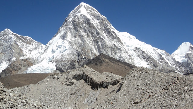
Everest trekking is so popular because of the highest mountain Everest. Kalapathar (5550m) and Gokyo-Ri (5300m)  are the best view point for Everest.  The attractions of the Everest region include spectacular scenery and the outgoing Sherpa people of the Solu Khumbu,mountains, glaciers, lakes etc. We find many types of trees and wild life in this region. We can see Chir pine, Blue pine, Junipar, different types of rhododendron and many kinds of herbs and flowers. Probably we can see that birds are Impheyan Pheasant (national bird of Nepal), Crimson-horned Pheasant, Snow pigeon, Golden Eagle, Snow Cocks etc. and animals are Musk Deer (rare animal in the world) and Himalayan Thar etc. It is believed that Yeti lives in this region. The Everest trekking starts from Phakding (2840m.) and passes through Namche Bazaar.The popular trekking routs are Everest Base Camp Trekking, Gokyo Trekking, Gokyo-Cholapass-Everest Base Camp Trekking, Tengboche Trekking, Three (Renjo-la, Cho-la and Khongma-la ) pass (including Everest base camp) Trekking in the Everest Region.

Everest Trekking Guide

Trekking in Nepal

Nepal Himalaya is the best place for Trekking. Many trekking regions and routs are identified in hilly and mountain region of Nepal. The popular trekking regions of Nepal are The Everest Region, Annapurna Region and The Langtang Region. The attractions of each region is different in terms of Mountains, Peaks, Rivers, Wild life, Flora and fauna, People and Culture. So, Trekking region depends upon your interest. You have to choose Trekking region and route. Some popular trekking routes are - Everest Base Camp Trekking, Gokyo Trekking, Gokyo - Chola pass - Everest Base Camp Trekking, Annapurna Round Trekking, Annapurna Base Camp Trekking, Ghorepani (Poonhill) Trekking, Langtang Trekking, Helambu Trekking etc.

      Annapurna Region is the most popular trekking area of Nepal. The region provides wonderful view of many mountains. The cultural varieties, different communities, famous Gorkha Soldiers and fortress, villages make each day walk a different experience. We can see Mountain Manaslu (8151m.), Annapurna I (8091m.), Annapurna II (7937m.), Annapurna III (7555m.), Annapurna IV (7525m.), Annapurna South (7219m.), Gangapurna (7454m.), Khangsar (7485m.), Dhaulagiri (8167m.), Tilicho (7134m), Chulu (6584m.) Tukuche (6920m.), Machhapuchhre (Fishtail 6997m.), Himchuli (6441m.) Lamjung Himal (6989m.) etc.

      Everest (Khumbu) Region is very popular, not only for the highest mountain Everest but also for Sherpa village, Monastery, Flora and Fauna, hundreds of high Mountains, many big Glaciers and Rivers. The attractions include spectacular scenery and the outgoing Sherpa people of the Solu Khumbu, Everest view point the region where Mt. Everest (8848m.) and its attendant lesser peaks are located. We can see Kusum Kangaru (6367m.), Kongde (6186m.), Thamserku (6608m.), kangtega (6685m.) Taboche (6367m.), Cholatse (6335m.), Amadablam (6856m.), Island Peak (6189m.), Lhotse (8414m.) Lobuche ( 6119m.), Nupse (7861m.), Pumo Ri (7165m.) and other many mountains and small peaks.

     Langtang lies the north of the Kathmandu Valley and just south of the Tibetan boarder. It is sandwiched between the main Himalayan range to the north and a slightly lower range of snowy peaks to the south. To the west of Langtang is Ganesh Himal with a range of 6,000 to 7,000 meters. The northern parts of the area largely fall within the boundaries of Langtang National Parks. A visit to the Langtang Valley offers an opportunity to explore villages, climb small peaks and visit glaciers at a comfortably low elevation. The forests in this region have temperate and sub- alpine vegetation. Wildlife includes migratory birds, deer, monkeys, Thar, and Pika. The scenery here is spectacular and the trekking is more adventurous.The main highlights of the Langtang Excursion Trek are Langtang National Park, Kyangjing Gompa, Yak Cheese factory, typical Tamang villages and diversity of flora and fauna. The main ethnic groups are Sherpa and Tamang whose religious practices, languages and dress are much similar to those of Tibet.

     Trekking guides are available where ever you want trekking in Nepal. Trekking guide are chipper or economy, honest and strong for mountain regions. Fanindra rai is a professional Trekking Guide in Nepal. After long time working in this field, he has been Trekking Guide in Nepal. He has trekking guide license issued by the Nepal Government. He wants to make career in tourism field so he is working very honestly, continues, up to dating and getting more knowledge which need to make best adventure for the guest. Nepal has unique diversity in geographical, climatic, biological, people, cultural, religion etc. More than 110 languages are speaking by the more than 92 ethnic groups in Nepal. Nepal is small in area but it takes time to understand east to west, and north to south of Nepal.
Yak Trekking in nepal

Sustainable Tourism in Nepal Himalaya

The term sustainable tourism is aggregate form of community based tourism or Eco tourism or green tourism, which refers to preserve localit...