Annapurna Region- Introduction- Since it opened to foreign
trekkers in 1977, the Annapurna region has become the most popular trek in
Nepal. The Annapurna Mountains are
different, in that the border is well to the north so the Jomsom and Annapurna circuit
treks both go north of the Himalayan watershed, into the high-altitude, dry,
desert area which is characteristic of the Tibetan Plateau. The Annapurna
Conservation Area Project (ACAP) is working to conserve the natural and
cultural resources of the Annapurna area.
Annapurna circuit (Thorong –La Pass) Trekking – This trek
takes 17 days and reaches a maximum height of 5416m at Thorong - La. The
circuit is usually walked in anti-clock wise direction because clockwise is the
longer ascent and shorter descent from west to east for the day of Throng-La
pass at 5416m.
The trek starts from Beshisahar, Lamjung and ends in big
touristic city Pokhara. We have to
fallow frist Marshyandi River and then Kaligandaki River. In this trekking, we
can see Mountain Manaslu (8151m.), Annapurna I (8091m.), Annapurna II (7937m.),
Annapurna III (7555m.), Annapurna IV (7525m.), Annapurna South (7219m.),
Gangapurna (7454m.), Khangsar (7485m.), Dhaulagiri (8167m.), Tilicho (7134m),
Chulu (6584m.) Tukuche (6920m.), Machhapuchhre (Fishtail 6997m.), Himchuli
(6441m.) etc. This region is rich in flora and fauna.
 |
| Annapurna Circuit Trekking |
I T I N E R A R Y
- Kathmandu to Beshisahar 180km, 7 hour drive
- Beshisahar to Bahundanda (5-6 hours) – At the north end of the Beshisahar bazaar, trail follows staircase down to Puwa Khola (Small river), cross and just walk along the road. We find some small tea shop on the way. Next is Balam Khola. There will be wooden bridge in summer time, even in the month October –November. After 1.30 hours from Beshisahar we get Khudi village. We have to cross Khudi river by suspension bridge. After 40 minutes, we have to cross the Marshyandi River by suspension bridge at Bhulbhule. There are many lodges as well as ACAP check post. There is Lampata village before Ngadi village, cross the Ngadi River. The way is up from Ngadi to Bahundanda (hill). It takes 3.30 hours from Bhulbhule to Bahundanda (1310m.)
- Bahundanda to Chamje (6 hours) – The way is steep down and straight to Konigau. There are a few lodges. Next village is Ghermu Phant, there are many lodges. From Ghermu Phant, the way is down to Syange with the frontal view of water fall. We have to cross Marshyandi River by suspension bridge. There are some lodges in Syange. The way is straight from Syange to Shri Chour, then walk up and down to Jagat. There is big settlement. And slightly up way to Chamje at 1433m. We can see the 200m. beautiful waterfalls before Chamje.
- Chamje to Danaqu (7hours)- Cross the Marshyandi river nearby Chamje. We can see marijuana on the trail side. Tal is big village. We have to cross 3 times suspension bridge of Marshyandi River from Tal to Dharapani. There is ACAP check post and many lodges in Dharapani. Trekking trail from Manaslu Round (Larke –pass) joins there in Dharapani. The way is straight and slightly up from Dharapani to Danaqu (2300m.). We can see Manaslu to east from Danaqu.
- Danaqu to Chame (5 hrs.) – The way is up from Danaqu to Timang (2750m.) Timang village is beautiful, good view of Manaslu. After Timang, the way is straight, a little down and short up to Koto. The Koto is gateway to Nar- Phoo trekking. There is ACAP check post. It takes 40 min. from Koto to Chame (2670m.) Chame is district headquarter of Manang. There is big settlement with charming view of Lamjung Himal.
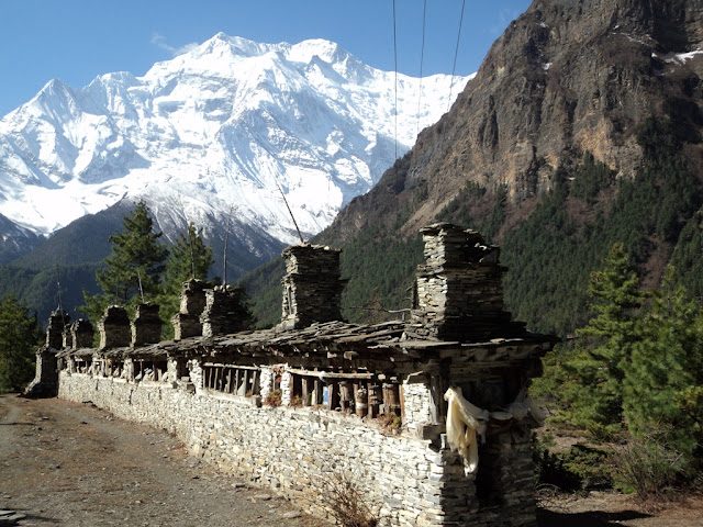
- Chame to Pisang (6 hours) - There is suspension bridge at the end of Chame village. After crossing the river, we get good view of Lamjung Himal and down ridge of Annapurna II from the trail. The trail is straight to Bhratang. There is long mani wall. After some time from Bhratang, again cross the Marshyandi River and trail is up to Dhikur Pokhari. There is pound and some restaurant. The trail is straight from Dhikur Pokhari to Pisang (3200m.)
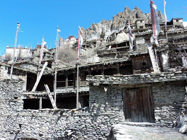
- Pisang to Manang (6 hrs.) - There are two trails to get Manang. The short rout is along the Marshyandi River and alternative route, longer route is through the Ghyaru and Ngawal village. Most of trekkers use this longer trail. The way is first straight and then up from Pisang to Ghyaru (3673m.) and straight to NGawal (3650m.). These villages are very old and traditional with the panoramic view of Annapurna range and Gangapurna. The trail bends down from Ngawal to Mungi, where joins the main trail from Pisang, and straight way to Manag through the Braka village.
- Manang to Yakkharka (4hpurs) – The trail is up to Tanki village (last traditional village). The way is slightly up from Tanki to Yakkharka (4050m.). We probably find yak pasturing. Yakkharka means yak paturing.
- Yakkharka to Thorong Phedi (3 hrs.) – Way is slightly up to Ledar. After Ledar, the way is straight short down and short up. We find a tea shop. Probably we can see the wild animal Blue Sheep. The trail is straight from the tea shop to Thorong Phedi (4550m.)
- Thorong Phedi to Muktinath (8 hours) – The very beginning trail is steep up an hour to high camp, and slightly up and up to Thorong la top. It takes 4 hours from Thorong Phedi to top at 5416m. and another 3 hours from top to Muktinath (3800m.)
- Muktinath to Jomsom (5 hours) - Trek to Jomsom descends from here, with views of the Kaligandaki River far below and Nilgiri and Dhaulagiri peaks towering in the west. At Eklobhatti Village the trail conjoins with the path from Kagbeni winding along the valley floor through beautiful barren lands with snow capped peaks in the distance.
- Jomsom to Tukche (4 hrs) - Trek along a river bed (where you can look for ammonite fossils) and then by apple, peach and apricot orchards. We will pass through Marpha, a peaceful Tibetan settlement with a large temple and monastery, before reaching Tukche.
- Tukuche to Ghasa (6 hour)- We trek along the river valley with a few tributary crossings before reaching Larjung. After Dhampu the scenery changes dramatically, as we enter a pine forest with lush vegetation and have beautiful views of Mt. Dhaulagiri and the Annapurna region. The trek from Kalopani to Lete Khola gradually goes down before the final climb to Ghasa.
- Ghasa to Tatopani (6 hour) - The trek is a gradual descent through valleys and fields with beautiful rupse chahara (waterfall) along the way. We will stop in Dana Village, site of the deepest gorge in the world, and have lunch. Tatopani (hot water), where we will be stopping, is home to some wonderful hot springs that sit beside the icy river. It is here that you will have your first opportunity in many days to have a nice soak.
- Tatopani to Ghorepani 7 hour - This 13km/7hrs trek is a challenging ascent, but it is well worth the sunset view over the profiles of Mt. Dhaulagiri and Annapurna.
- Ghorepani to Pokhara - The day begins with a pre-sunrise hike (45 minutes) up to Poon Hill (3,193m/10,505ft), the highest hill on the entire trek, for amazing views and photo opportunities of the Mustang and Pokhara Valleys. From the top you can see as many as 30 snow capped peaks, including the Annapurna range and Dhaulagiri. Trek 16km/6.5hrs down to Nayapul (1,100m/3,619ft) and drive 33km (1 hr) to Pokhara.
- Pokhara to Kathmandu 210 km 7 hour drive.


